


Somewhat Walkable
59
Walk Score ®
Out of 100
You might be able to get out and walk when living in this area. Some errands can be accomplished on foot, but for others you’ll need a car.

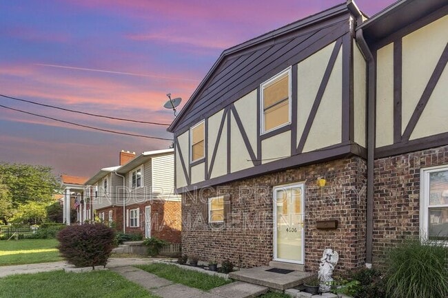
4606 Glenway Ave, Cincinnati, OH 45238
4606 Glenway Ave, Cincinnati, OH 45238
Url: http://offcampus.xavier.edu/housing/property/4606-glenway-ave/t942gdb
Phone Number: (561) 621-5853
Data provided by TravelTime
| Number of Bedrooms | Number of Bathrooms | Rent Range | Square Footage | Name of Floor Plan | Unit Number | Availability | Newly Added | View More Details |
|---|
| Western Hills Wing Optical Strip Center | <span class="bold">Walk:</span> <span class="mobile-font">21 min</span> <span class="mobile-font">(1.1 mi)</span> |
| Lavender Field Shopping Center | <span class="bold">Walk:</span> <span class="mobile-font">28 min</span> <span class="mobile-font">(1.5 mi)</span> |
| Western Hills Square | <span class="bold">Walk:</span> <span class="mobile-font">27 min</span> <span class="mobile-font">(1.4 mi)</span> |
| Cincinnati Union Terminal | <span class="bold">Drive:</span> <span class="mobile-font">11 min</span> <span class="mobile-font">(4.2 mi)</span> |
| Elm & Liberty Station | <span class="bold">Drive:</span> <span class="mobile-font">12 min</span> <span class="mobile-font">(4.7 mi)</span> |
| Brewery District Station, Elm & Henry | <span class="bold">Drive:</span> <span class="mobile-font">11 min</span> <span class="mobile-font">(4.7 mi)</span> |
| 14Th & Elm Station | <span class="bold">Drive:</span> <span class="mobile-font">12 min</span> <span class="mobile-font">(4.8 mi)</span> |
| Findlay Market-Race Station, Race & Elder | <span class="bold">Drive:</span> <span class="mobile-font">11 min</span> <span class="mobile-font">(4.9 mi)</span> |
| Findlay Market-Elm Station, Elm & Glass Alley | <span class="bold">Drive:</span> <span class="mobile-font">12 min</span> <span class="mobile-font">(5.0 mi)</span> |
| Cincinnati/Northern Kentucky International | <span class="bold">Drive:</span> <span class="mobile-font">34 min</span> <span class="mobile-font">(18.0 mi)</span> |
| College of Mount St. Joseph | <span class="bold">Walk:</span> <span class="mobile-font">69 min</span> <span class="mobile-font">(3.6 mi)</span> |
| University of Cincinnati | <span class="bold">Drive:</span> <span class="mobile-font">14 min</span> <span class="mobile-font">(5.8 mi)</span> |
| Cincinnati State | <span class="bold">Drive:</span> <span class="mobile-font">15 min</span> <span class="mobile-font">(6.1 mi)</span> |
| Univ. of Cincinnati, Medical | <span class="bold">Drive:</span> <span class="mobile-font">15 min</span> <span class="mobile-font">(6.3 mi)</span> |
| Imago Earth Center | <span class="bold">Walk:</span> <span class="mobile-font">30 min</span> <span class="mobile-font">(1.6 mi)</span> |
| Wilson Commons | <span class="bold">Walk:</span> <span class="mobile-font">44 min</span> <span class="mobile-font">(2.3 mi)</span> |
| Embshoff Woods | <span class="bold">Walk:</span> <span class="mobile-font">48 min</span> <span class="mobile-font">(2.5 mi)</span> |
| Cincinnati History Museum | <span class="bold">Drive:</span> <span class="mobile-font">11 min</span> <span class="mobile-font">(4.2 mi)</span> |
| Museum of Natural History and Science | <span class="bold">Drive:</span> <span class="mobile-font">11 min</span> <span class="mobile-font">(4.2 mi)</span> |